
A longer route route to Berry Creek Falls, one of the best hikes in the bay area
Location: Big Basin Redwoods State Park
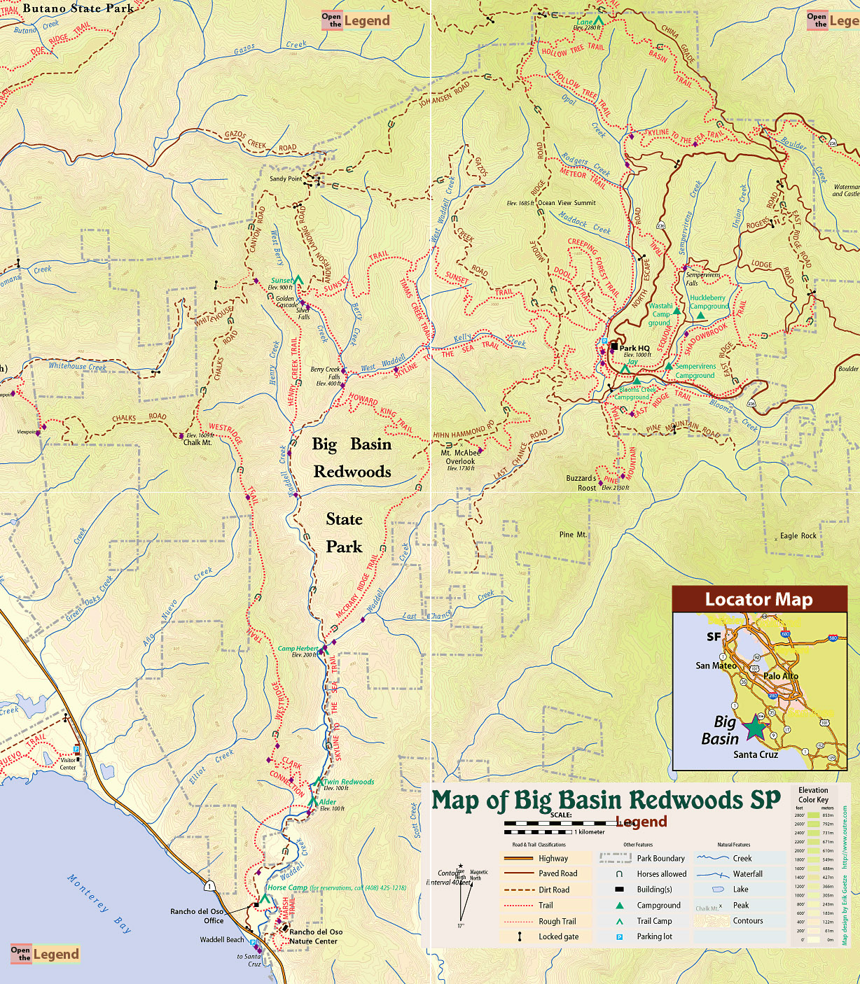
» RedwoodHikes Trail Map for this hike: Awesome contoured map showing all trails clearly. Thanks to Dave Baselt for sharing this map for free.
» Official Map: Large sized map without mileage information.
» Mappery.Com Trail Map: Good quality map showing various trails. Mileage of trail sections is missing. This is a JPEG image of the Virtual Parks trail map.
» Redwood Hikes Map: Bay Area Trail Map: Saratoga to Big Basin, First edition, 2010. This is an excellent map sold by Dave Baselt ($6.95 in Dec 2011). This map is useful for exploring many parks in this area. Highly recommended for avid hikers.
To Berry Creek Falls (5.7 miles): Hop onto Skyline to the Sea Trail from Park HQ. There are lots of trails near Park HQ: this map is helpful. Keep following Skyline to the Sea Trail (1.0 miles) to reach a five-way junction (the trails do not meet at exactly the same points but are nearby) with Howard King Trail and Middle Ridge Road. Follow Howard King Trail (4.4 miles). Howard King Trail and Hammond Road are intertwined. So there are repeated points of intersection between the two trails. In fact, a section of Howard King Trail is identical to Hammond Road. Eventually, Howard King Trail meets Skyline to the Sea Trail. Turn right and follow Skyline to the Sea Trail (0.3 miles) to reach Berry Creek Falls.
To Park HQ (6.3 miles): From Berry Creek Falls, follow Berry Creek Fall Trail (1.0 miles) → right on Sunset Trail (5.0 miles) → right on Skyline to the Sea Trail (0.3 miles) to reach Park HQ.


 Full photo album — 25 February 2012
Location: 21600 Big Basin Way, Boulder Creek, CA 95006 . Parking area is not visible in Google Maps.
Google Maps:
Parking Fees: $10 per vehicle. (last visited: Jan 2012)
Capacity: Multiple parking lots. Dozens of cars may be parked inside the park.
Latitude: 37.171311 Longitude: -122.222203