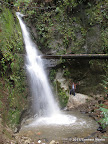
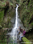
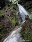
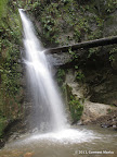
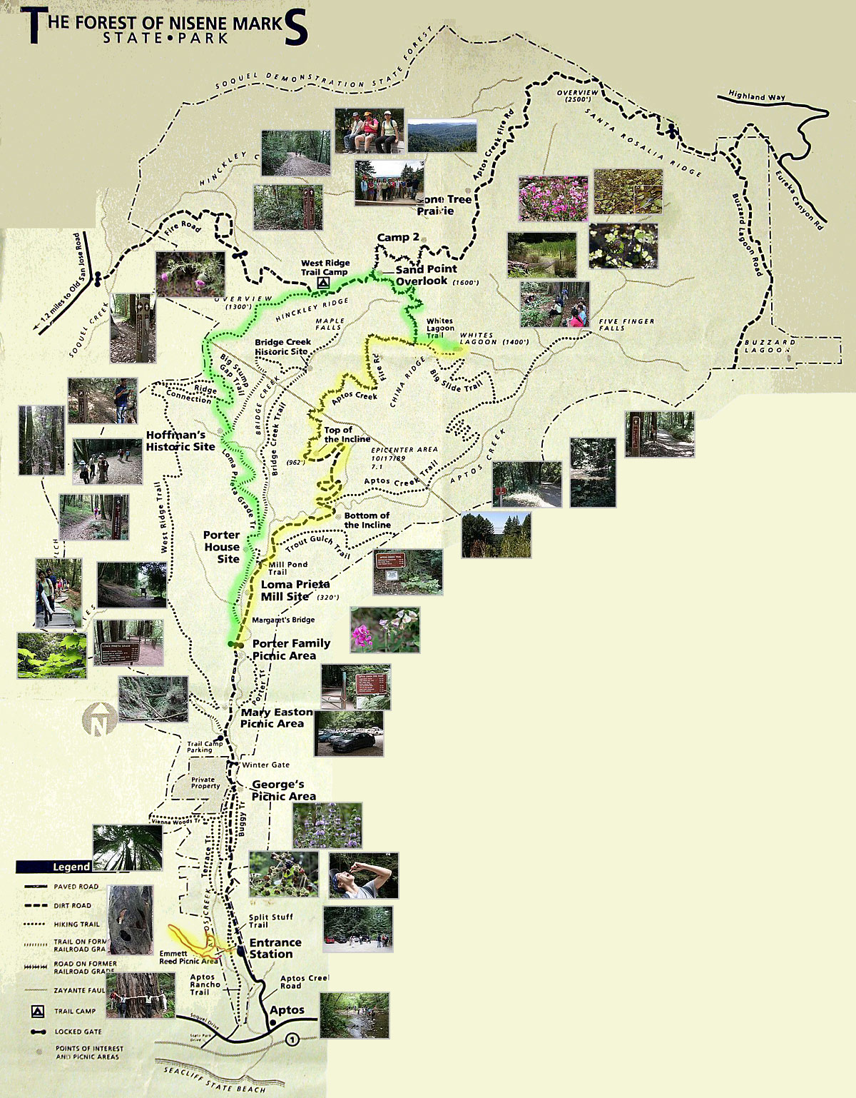
Maple Falls is a fantastic destination in Forest of Nisene Marks. It is a seasonal waterfall that is quite majestic after heavy or sustained rains in winters. So the best time to visit is December to February, after a thunderstorm.
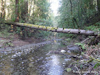
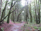
What is special about any hike to Maple Falls? The last half mile of the hike meanders along Bridge Creek, switching sides almost ten times. Each time the trail switches sides, we have to cross the creek. There are no bridges, so we're bound to get our feet wet! In Jan 2011, after heavy rains, water level was between 6 and 11 inches deep. At a few places, scrambling was necessary. In winters, the hiking trails in Forest of Nisene Marks are gorgeous, making any route to Maple Falls worthwhile.
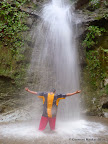
In March 2014, a group of us actually stood under the waterfall and posed for photos. That was a lot of fun!
|
8.6 miles
800 ft |
Route I |
|
10.1 miles
1000 ft |
Route II |
|
10.9 miles
1700 ft |
Route III |
|
13.5 miles
2500 ft |
From Land of Medicine Buddha |
Five Finger Falls is not a spectacular waterfall by any means. However, the hike to the falls is spectacular, going through lush green forest in winters. Highly recommended hike for seasoned hikers. In November 2009, Aptos Creek Trail and Big Slide Trail seemed unmaintained, giving us the feeling of being in wilderness.
|
11.8 miles
1100 ft |
Route I |

|
15.5 miles
2200 ft |
Route II |

In winters, a hike that combines both Five Finger Falls and Maple Falls is going to be long but rewarding. Below are listed various ways to combine these two destinations. All routes are between 18 and 21 miles long, even though visually, they look very different on a map.
|
18.3 miles
2000 ft |
Route I |
|
20.5 miles
2200 ft |
Route II |
|
21.3 miles
3100 ft |
Route III |
|
20.4 miles
3000 ft |
Route IV |
|
20.8 miles
3700 ft |
Route V |

|
19.6 miles
2600 ft |
Route VI |
|
19.4 miles
3600 ft |
Route VII |
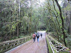
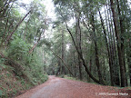
Sand Point Overlook lies in the northernmost part of Forest of Nisene Marks. It is reachable via a long fire road called Aptos Creek Fire Road in the east, and by single track hiking trails in the west. So whatever route you pick, half of the hike is going to be along a fire road. The road is pretty, shaded by tall trees.
|
13.3 miles
1700 ft |
Route I |

|
13.5 miles
2000 ft |
Route II |

|
14.5 miles
1600 ft |
Route III |

A couple of routes in the western section of the park. These routes do not visit any waterfall and do not go via Sand Point Overlook. However, the trails are pretty awesome in any season.
|
8.0 miles
1300 ft |
Route I |
|
9.5 miles
1500 ft |
Route II |

|
8.7 miles
900 ft |
Hoffman Historic Site - Route III |
|
15.9 miles
2100 ft |
Route I |
|
20.2 miles
2700 ft |
Route II |
|
16.7 miles
2500 ft |
Route I |

|
17.2 miles
2500 ft |
Route II |

The routes below combine an exploration of the western ridge and Five Finger Falls in the north east.
|
18.7 miles
2600 ft |
Route I |
|
21.2 miles
3300 ft |
Route II |
|
4.5 miles
600 ft |
Aptos Rancho Trail |

|
6.9 miles
800 ft |
Aptos Rancho Trail - Porter Trail |
Trout Gulch Trail is not shown all maps. Trail Map at Signite.Com shows its location near the location called 'Bottom of Incline'. In March 2012, the trail appeared overgrown but sufficiently visible that we were never lost.
|
6.0 miles
800 ft |
Route I |

|
8.1 miles
800 ft |
Route II |