Hikes in Purisima Creek Redwoods Open Space Preserve
1 Jan 2012

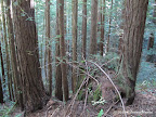
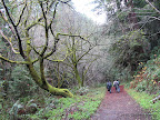
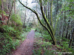
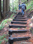
Purisima Creek Redwoods is a gem of a park in the bay area. It offers beautiful shaded hikes among tall redwoods. The park has four entrances. The East and West entrances are connected by Purisima Creek Trail, which runs adjacent to a fairly wide creek. The creek has water throughout the year. Purisima Creek Trail divides the park into two sections: in the north, trails climb up to the North Entrance via Craig Britton Trail, Harkins Ridge Trail and Whittemore Gulch Trail. In the south, there is a loop formed by Borden Hatch Mill Trail and Grabtown Gulch Trail.

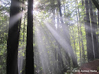
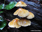
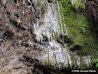
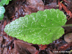
Best time to visit: Winters, after rains, when water levels in Purisima Creek are the highest. Also, vegetation is lush green after rains.

Hikes: All routes below are equally awesome. First, identify the entrance that is closest to your location. For residents of south bay, north and east entrances are most accessible. The west entrance is accessible only from Hwy 1, making it a long ride if you are starting from south bay. After choosing an entrance, pick a hike according to the distance and elevation that best suits you.

Hikes from East Entrance
8.2 miles
1600 ft
Route I
All along Purisima Creek Trail connecting the east and west entrances.

10.6 miles
1900 ft
Route II
A gorgeous route via Craig Britton Trail, Harkins Ridge and Purisima Creek Trail.

10.5 miles
2400 ft
Route III
Beautiful loop around Borden Hatch Mill Trail and Grabtown Gulch Trail from East Entrance.

13.5 miles
2600 ft
Route IV
Nice loop through Purisima Creek Redwoods that goes through all three park entrances: east, north and west.

14.7 miles
3100 ft
Route V
A long loop going through Harkins Ridge, Craig Britton, Borden Hatch Mill and Grabtown Gulch trails.

17.6 miles
3600 ft
Route VI
Long loop through Purisima Creek Redwoods that goes through all three entrances: east, north and west.

13.2 miles
2700 ft
Route VII
Nice loop through Purisima Creek Redwoods going through Craig Britton and Harkins Ridge trails, with a sie trip to the north entrance.

Hikes from North Entrance
7.1 miles
1500 ft
Route I
Nice loop through Whittemore Gulch and Harkins Ridge, starting at the north entrance.

9.9 miles
1800 ft
Route II
A long loop through Craig Britton, Purisima Creek and Harkins Ridge trails, starting at the north entrance.

9.7 miles
1800 ft
Route III
Nice loop through Craig Britton, Purisima Creek and Harkins Ridge trails.

13.4 miles
2900 ft
Route IV
A long route visiting Grabtown Gulch and Borden Hatch Mill trails, starting at the north entrance.

14.0 miles
2700 ft
Route V
Nice, long loop visiting Grabtown Gulch and Borden Hatch Mill trails.

13.8 miles
2700 ft
Route VI
Nice, long loop visiting Borden Hatch Mill and Grabtown Gulch trails, starting at the north entrance.

17.6 miles
3600 ft
Route VII
Long route in Purisima Creek Redwoods that goes through all three entrances: east, north and west. Visits Grabtown Gulch and Borden Hatch Mill trails as well.

17.4 miles
3600 ft
Route VIII
Long loop through Purisima Creek Redwoods that visits all three entrances: east, north and south. Also goes through Grabtown Gulch and Borden Hatch Mill trails.

13.5 miles
2600 ft
Route IX
Nice loop through Purisima Creek Redwoods that visits all the entrances: east, north and west.

13.3 miles
2600 ft
Route X
A long loop through all three park entrances: east, north and west.

Hikes from West Entrance
7.1 miles
1500 ft
Route I
Nice loop to North entrance via Whittemore Gulch and Harkins Ridge trails.

7.0 miles
1100 ft
Route II
A beautiful loop through Craig Britton and Harkins Ridge trails.

6.3 miles
1200 ft
Route III
A shaded loop visiting Grabtown Gulch and Borden Hatch Mill trails, starting at the west entrance.

9.9 miles
1800 ft
Route IV
A route visiting the North entrance via Whittemore Gulch and Craig Britton trails.

13.4 miles
2900 ft
Route V
A long loop visiting the north entrance via Whittemore Gulch and Harkins Ridge trails. Also visits Grabtown Gulch and Borden Hatch Mill trails.

11.1 miles
2200 ft
Route VI
Pleasant route via Harkins Ridge, Craig Britton trails in the north and Grabtown Gulch, Borden Hatch Mill trails in the south.

14.0 miles
2700 ft
Route VII
Long loop visiting the north entrance via Whittemore Gulch and Craig Britton trails. Return journey via Grabtown Gulch and Borden Hatch Mill trails.

10.6 miles
2000 ft
Route VIII
Nice, shaded loop all along Purisima Creek trail from west entrance to the east. Return trip by Craig Britton and Harkins Ridge trails.

13.5 miles
2600 ft
Route IX
Long loop in Purisima Creek Redwoods visiting all three entrances: north, east and west.

14.7 miles
2800 ft
Route X
Beautiful, long route in Purisima, going through Grabtown Gulch and Borden Hatch Mill trails in the south and Harkins Ridge and Craig Britton trails in the north.

17.6 miles
3600 ft
Route XI
A long route that goes through all three entrances: north, east and west. Also visits Grabtown Gulch and Borden Hatch Mill trails.

8.2 miles
1600 ft
Route XII
A walk along Purisima Creek Trail from west to east entrance.

Hikes from South Entrance
5.8 miles
1200 ft
Bald Knob - Irish Ridge
An interesting hike through redwoods and green rolling hills in a rarely visited part of Purisima Creek.

8.0 miles
1400 ft
Bald Knob - Irish Ridge - Lobitos Creek
An interesting hike through redwoods and green rolling hills in a rarely visited part of Purisima Creek. In June 2010, some bushwhacking required towards the end.

© Copyright 2008—2023, Gurmeet Manku.