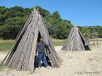
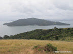
Tomales Bay has four different beaches next to the blue placid water of Tomales Bay. All four beaches may connected in one long route.
|
10.7 miles
1500 ft |
Four Beaches from Camino Del Mar |

On a clear day, East Peak in Mt Tamalpais offers incredible views of San Pablo Bay and San Francisco Bay. Mt Tamalpais is criss-crossed by myriad trails, so there are multiple hikes to East Peak from different trailheads.
|
10.1 miles
2000 ft |
East Peak from Pantoll Ranger Station — Route I |

|
5.0 miles
1600 ft |
East Peak from Fern Canyon Road — Route I |

|
7.0 miles
1800 ft |
East Peak from Fern Canyon Road — Route II |
The views from Hill 88 in Marin Headlands are quite incredible. Hill 88 lies near the intersection of Wolf Ridge Trail and Coastal Trail. It is reachable by a side trip along a paved road. Since it requires a side trip, many hikers do not climb the hill and bypass it, thereby missing out on incredible views of San Francisco Bay, the Pacific Ocean and various valleys in Marin Headlands.
A second great location for bay views, including the Golden Gate Bridge is along the south east section of Marin Headlands. The hike to Black Sands Beach has details.
|
9.5 miles
1500 ft |
Rodeo Beach - Black Sands Beach Loop |

|
7.4 miles
1800 ft |
Golden Gate Bridge to Black Sands Beach |

Fanastic views of San Francisco Bay, Tiburon peninsula and various bridges near the bay.
|
10.6 miles
1400 ft |
Grand Loop in Angel Island |

China Camp is adjacent to San Pablo Bay.
|
11.8 miles
1200 ft |
Grand Loop in China Camp |

Point Pinole lies adjacent to San Pablo Bay.
|
5.6 miles
300 ft |
Grand Loop in Point Pinole Shoreline |

Miller-Knox Shoreline is a small park that offers two short hikes: one amid the hills with great views of San Francisco Bay and another hike all along the shoreline.
|
3.5 miles
800 ft |
Miller-Knox Hills Loop |

|
2.0 miles
0 ft |
Miller-Knox Shoreline Walk |
There are multiple short routes to reach the top of Ring Mountain. Expansive views of San Pablo Bay and San Francisco Bay are available from trails near the top.
|
3.5 miles
700 ft |
Ring Mountain from Paradise Drive |

Old St Hilary's is a small park in Tiburon that offers short hikes with incredible views of Angel Island and San Francisco Bay.
|
1.0 miles
100 ft |
Angel Island Views at Old St Hilary's |

|
1.0 miles
100 ft |
Old St Hilary's Church |
Mission Peak is arguably the most popular hike in the bay area. Every day, dozens of individuals hike three miles from the Stanford Avenue trailhead to the top of Mission Peak, gaining 2100 ft in the process. Views of East Bay and San Francisco Bay are pretty awesome. If the hike is started early morning, before sunrise, then the views coming downhill are pretty awesome as the sun rises in the east.
|
6.1 miles
2100 ft |
Mission Peak from Stanford Ave - Route I |

Coyote Hills is a small park in Fremont overlooking San Francisco Bay. It offers quick short hikes with awesome views of the bay and marshlands adjoining the park.
|
3.3 miles
300 ft |
Short Hike in Coyote Hils |

San Bruno Mountain has a Ridge Trail which is over two miles long. One gets to see San Francisco Bay on one side and the Pacific Ocean on the other side all along this trail. From the parking lot, the trails that lead up to Summit Trail are full of wildflowers in spring. So the best time to enjoy both wildflower displays and bay views is the month of March.
|
8.3 miles
1500 ft |
Summit Loop - Ridge Trail |

Trails in Alviso Marina offer a sense of expansiveness and seclusion. The trails are along levees surrounding protected marshlands. There is a sense of quiet in Alviso Marina.
|
14.5 miles
100 ft |
Grand Loop in Alviso Marina |

Point Isabel in Richmond offers short hikes along the shoreline of San Francisco Bay. It is full of dog lovers who come to this park with their dogs. On a typical weekend, you may see a few hundred dogs.
|
2.1 miles
0 ft |
Point Isabel Shoreline Walk |

Hikes in Palo Alto Baylands are most awesome in early morning and late evening, during sunrise and sunset respectively. Hiking trails meander next to marshlands that are inhabited by thousands of birds. Some trails have water bodies on both sides. The reflections of clouds and sun make sunrise and sunset particularly beautiful.
|
5.3 miles
0 ft |
Adobe Creek Loop |

Candlestick Point offers two short hikes with bay views. However, the hikes are quite close to roads, so traffic noise is quite prominent.
|
2.1 miles
50 ft |
Bay Trail in Candlestick Point |

|
2.5 miles
50 ft |
Candlestick Point |
|
10.1 miles
50 ft |
Long Walk Along Hayward Shoreline |

|
7.1 miles
50 ft |
Long Walk in Martin Luther King Jr Shoreline |

|
4.1 miles
0 ft |
Middle Harbor Shoreline Walk |

|
2.4 miles
100 ft |
Oyster Bay Loop |

|
2.6 miles
50 ft |
Short Walk in Ravenswood |


