
Nice long hike to Berry Creek Falls along Skyline to the Sea trail
Location: Big Basin Redwoods State Park
» RedwoodHikes Map: Excellent map showing Skyline to the Sea Trail all the way from Waddell Beach to Berry Creek Falls (same as Viewing Platform in the top right corner of the map)
» Official Map: Large sized map without mileage information.
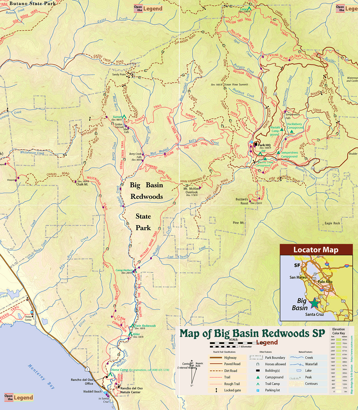
» Mappery.Com Trail Map: Good quality map showing various trails. Mileage of trail sections is missing. This is a JPEG image of the Virtual Parks trail map.
» Redwood Hikes Map: Bay Area Trail Map: Saratoga to Big Basin, First edition, 2010. This is an excellent map sold by Dave Baselt ($6.95 in Dec 2011). This map is useful for exploring many parks in this area. Highly recommended for avid hikers.
To Berry Creek Falls: Follow Skyline-to-the-Sea Trail all the way to Berry Creek Falls. Return by the same route.
Notes: Along Skyline to the Sea Trail, one of the creek crossings close to Waddell Beach had no bridge. So we had to wade through cold water, which was not deep. By walking along Canyon Road instead of Skyline to the Sea Trail, the crossing can be bypassed.
Location: Rancho Del Oso Visitor Center, 3600 California 1, Davenport, CA 95017 . Parking area is visible in Google Maps if you zoom in sufficiently.
Google Maps:
Parking Fees: None (last visited: Jan 2011)
Capacity: Dozens of cars may be parked next to Waddell Beach.
Latitude: 37.097065 Longitude: -122.279597


 Full photo album — 8 January 2011


Full photo album — 8 January 2011