
Beautiful walk through redwoods, also visiting Berry Creek Falls along the way.
Location: Big Basin Redwoods State Park
» RedwoodHikes Map: Excellent map showing Skyline to the Sea Trail all the way from Waddell Beach to Berry Creek Falls (same as Viewing Platform in the top right corner of the map)
» Official Map: Large sized map without mileage information.
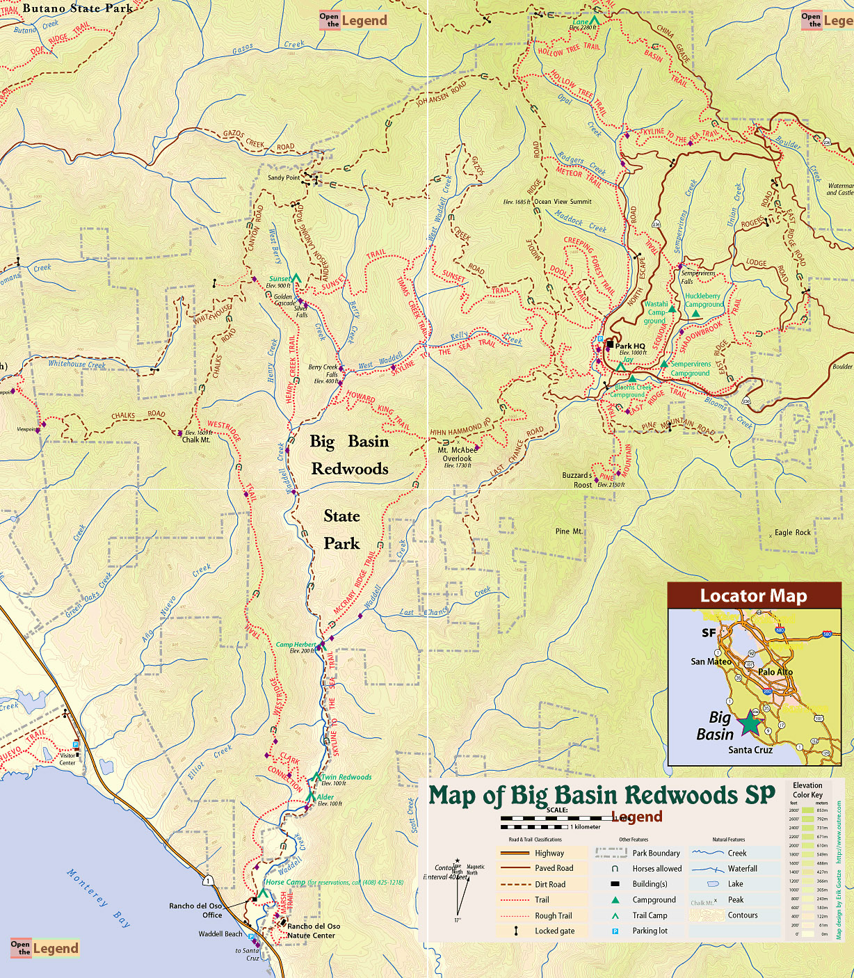
» Mappery.Com Trail Map: Good quality map showing various trails. Mileage of trail sections is missing. This is a JPEG image of the Virtual Parks trail map.
» Redwood Hikes Map: Bay Area Trail Map: Saratoga to Big Basin, First edition, 2010. This is an excellent map sold by Dave Baselt ($6.95 in Dec 2011). This map is useful for exploring many parks in this area. Highly recommended for avid hikers.
Location: 21600 Big Basin Way, Boulder Creek, CA 95006 . Parking area is not visible in Google Maps.
Google Maps:
Parking Fees: $10 per vehicle. (last visited: Jan 2012)
Capacity: Multiple parking lots. Dozens of cars may be parked inside the park.
Latitude: 37.171311 Longitude: -122.222203
Location: Rancho Del Oso Visitor Center, 3600 California 1, Davenport, CA 95017 . Parking area is visible in Google Maps if you zoom in sufficiently.
Google Maps:
Parking Fees: None (last visited: Jan 2011)
Capacity: Dozens of cars may be parked next to Waddell Beach.
Latitude: 37.097065 Longitude: -122.279597


 Full photo album — 8 January 2011


Full photo album — 8 January 2011