
A short hike in Portola Valley.
Location: Portola Valley Ranch - Coal Mine Ridge
 Large-sized Google Map
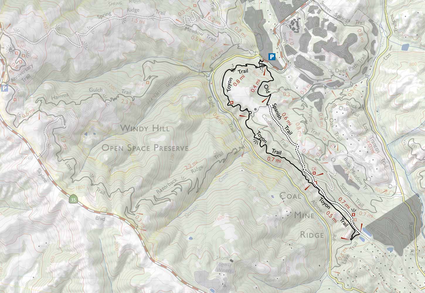
» RedwoodHikes Trail Map: Good map showing various trails along with their lengths.
» Official Trail Map at PortolaValley.Net: Good map showing various trails.
» Redwoodhikes Trail Map: Great map showing many parks like Purisima Creek, Huddart, Wunderlich, El Corte De Madera, Foothills, Hidden Villa and Rancho San Antonio. Trail maps for individual parks are available online for free. However, the RedwoodHikes map shows the big picture and is helpful for planning hikes that go through multiple parks.
Location: Intersection of Alpine Road & Willowbrook Drive, Portola Valley, CA 94028 . Parking area is not visible in Google Maps.
Directions: From Highway 280, take Exit 20 for Page Mill Rd and go south along Page Mill Rd. After 0.5 miles, turn right onto Arastradero Road. After 2.0 miles, turn left onto Alpine Road. In 2.1 miles, you will reach the intersection with Willowbrook Drive. Street parking is available here.
Google Maps:
Parking Fees: None (last visited: December 2011)
Capacity: About 10 cars may be parked here.
Latitude: 37.364508 Longitude: -122.215578


