Hikes in Castle Rock State Park
1 Jan 2012
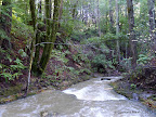
Castle Rock State Park is a large park with multiple trail heads along Highway 35 (Skyline Blvd) and Highway 9. Close to Park HQ, there are interesting rock formations. Hiking trails offer sweeping vistas of Monterey Bay and long pleasant walks through redwoods. The 28-mile Skyline to the Sea Trail starts at Park HQ and goes all the way to the Pacific Ocean.

Best Months to Visit: Winter and spring are best since the forest is especially green. Other seasons are good too since almost all trails are shaded.

Hikes from Saratoga Gap
7.2 miles
1000 ft
Route I
Pleasant, shaded walk through redwoods adjoining Highway 9.

9.4 miles
900 ft
Route II
Pleasant, shaded walk through redwoods adjoining Highway 9.

10.3 miles
1100 ft
Route III
Pleasant, shaded walk through Castle Rock.

15.0 miles
1900 ft
Route IV
Pleasant hike in the western section of Castle Rock.

12.2 miles
2000 ft
Route V
Great hike through quiet, shaded trails in Castle Rock.

13.0 miles
1600 ft
Route VI
Pleasant, shaded walk through Castle Rock.

18.5 miles
2300 ft
Route VII
Pleasant hike in the western section of Castle Rock.

14.2 miles
1700 ft
Route VIII
Pleasant hike in the western section of Castle Rock.

22.0 miles
2500 ft
Route IX
Pleasant hike in the western section of Castle Rock.

10.3 miles
1200 ft
Route X
Pleasant, shaded walk through redwoods adjoining Highway 9 and Highway 35.

13.5 miles
1600 ft
Route XI
Pleasant, shaded walk through redwoods adjoining Highway 9.

18.3 miles
2200 ft
Route XII
Pleasant hike in the western section of Castle Rock.

15.4 miles
2000 ft
Route XIII
Great hike through quiet, shaded trails in Castle Rock.

16.2 miles
2200 ft
Route XIV
Pleasant, shaded walk through Castle Rock.

21.7 miles
2600 ft
Route XV
Pleasant hike in the western section of Castle Rock.

17.4 miles
2200 ft
Route XVI
Pleasant hike in the western section of Castle Rock.

25.2 miles
3000 ft
Route XVII
Pleasant hike in the western section of Castle Rock.

6.5 miles
900 ft
Route XVIII
Great shaded hike through redwoods. The last two miles are along a paved road with residences.

Hikes from Park HQ
2.8 miles
800 ft
Route I
Quick hike in Castle Rock.

5.4 miles
1000 ft
Route II
A classic short hike in Castle Rock. A third of the route is over stony terrain providing beautiful views of Santa Cruz Mountains. The rest of the hike is shaded by forest.

7.0 miles
1000 ft
Route III
Pleasant, shaded walk through Castle Rock.

13.0 miles
1600 ft
Route IV
Pleasant, shaded walk through Castle Rock.

14.2 miles
1700 ft
Route V
Pleasant hike in the western section of Castle Rock.

22.0 miles
2500 ft
Route VI
Pleasant hike in the western section of Castle Rock.

16.2 miles
2200 ft
Route VII
Pleasant, shaded walk through Castle Rock.

17.4 miles
2200 ft
Route VIII
Pleasant hike in the western section of Castle Rock.

25.2 miles
3000 ft
Route IX
Pleasant hike in the western section of Castle Rock.

Hikes from Waterman Gap
8.9 miles
1100 ft
Route I
Pleasant hike in south-west section of Castle Rock.

14.0 miles
1800 ft
Route II
Pleasant hike in the western section of Castle Rock.

18.5 miles
2300 ft
Route III
Pleasant hike in the western section of Castle Rock.

22.0 miles
2500 ft
Route IV
Pleasant hike in the western section of Castle Rock.

18.3 miles
2200 ft
Route V
Pleasant hike in the western section of Castle Rock.

21.7 miles
2600 ft
Route VI
Pleasant hike in the western section of Castle Rock.

25.2 miles
3000 ft
Route VII
Pleasant hike in the western section of Castle Rock.

Michael's Summit
5.1 miles
1000 ft
Route I
A decent cardiovascular workout through redwoods to a remote section of Castle Rock.

4.4 miles
1000 ft
Route II
A decent cardiovascular workout through redwoods to a remote section of Castle Rock.

© Copyright 2008—2023, Gurmeet Manku.