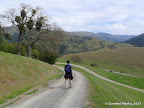
Hikes in Mission Peak Regional Preserve
1 Jan 2012
Mission Peak in Fremont, CA is arguably the most popular destination for hiking in the bay area. Everybody who has hiked in south bay has heard of the strenuous 6-mile, 2100 ft climb to the peak! The hike is a great cardiovascular workout but it is not the most scenic route.

Is Mission Peak a good first hike? For some people, the grueling climb to Mission Peak is their first and last hike. For those who make it to the top, the concept of hiking becomes synonymous to climbing a peak along steep, unshaded trails. The truth is that hiking can be a far more enjoyable experience! If you would like to introduce your friends, family, kids or spouses to hiking, I would suggest choosing some other route for your first hike. There are hundreds of other hikes in the bay area that offer gorgeous views of the Pacific coastline, lush green redwoods, creeks full of water, awesome waterfalls and so on.

Best Time to Visit: All routes to Mission peak are in the open. Routes from Ohlone College have some short wooded sections. Overall, there is hardly any tree cover. So summer jaunts to the peak are pretty challenging. The hike is best done in spring (March — May) when hills are lush green and temperature is moderate. Fall and winters are also pleasant though the hills are not as green. In summers, it’s quite hot and hills are brown and barren.

Mission Peak from Stanford Ave: Regular Routes

Most people visit Mission Peak from Stanford Avenue. The number of visitors is so large that the parking lot is invariably full within an hour of sunrise on weekends. Luckily, plenty of parking is available in the residential complexes within a half mile from the parking lot.

6.1 miles
2100 ft
Mission Peak from Stanford Ave - Route I
The most popular route to Mission Peak. When somebody says that they climbed Mission Peak, they are very likely referring to this route. The route is so popular that during regular hours on weekends, you may not even need a map as you could simply follow dozens of individuals headed up the peak.

6.0 miles
2100 ft
Mission Peak from Stanford Ave - Route II
An alternative route that returns via Horse Heaven Trail, which has some extraordinarly steep sections. Only a handful of Mission Peak visitors follow this route even though it is a nice variation.

6.0 miles
2100 ft
Mission Peak from Stanford Ave - Route III
This route follows Horse Heaven Trail for both ascent and descent. Horse Heaven Trail has some really steep sections.

Mission Peak from Stanford Ave: P Shaped Loops

These loops are variations of the standard routes to Mission Peak. The return trip is via Grove Trail or via Peak Meadow Trail.

6.5 miles
2100 ft
Route I
Ascent and descent along Ohlone Wilderness Trail. P shape is formed by Peak Trail and Grove Trail.

7.4 miles
2300 ft
Route II
Ascent and descent along Ohlone Wilderness Trail. P shape is formed by Peak Trail and Peak Meadow Trail.

6.7 miles
1900 ft
Route III
Ascent and descent along Ohlone Wilderness Trail. P shape is formed by Grove Trail and Peak Meadow Trail.

7.6 miles
2500 ft
Route IV
Ascent along Horse Heaven Trail. P shape is formed by Peak Trail and Grove Trail.

6.9 miles
2200 ft
Route V
Ascent along Horse Heaven Trail. P shape is formed by Peak Trail and Peak Meadow Trail.

6.3 miles
1800 ft
Route VI
Ascent along Horse Heaven Trail. P shape is formed by Grove Trail and Peak Meadow Trail.

Mission Peak from Stanford Ave: B Shaped Loops
7.1 miles
2200 ft
Route I
Ascent along Ohlone Wilderness Trail.

8.6 miles
2700 ft
Route II
Ascent along Peak Meadow and Horse Heaven Trail.

Mission Peak from Ohlone College

The route from Ohlone College has many more trees and much more solitude. Few people are familiar with this route. Instead of paid parking inside Ohlone College, one may park for free along Mission Blvd, where it intersects Pine St.

7.0 miles
2100 ft
Route I
A short hike from Ohlone College. Length and elevation gain are comparable to the regular route from Stanford Ave.

7.9 miles
2300 ft
Route II
A variation of the regular route from Ohlone College: from Mission Peak, it continues along Peak Trail, then returns via Grove Trail and Peak Trail. Gorgeous valley views

10.0 miles
2700 ft
Route III
A variation of the regular route from Ohlone College: from Mission Peak, it continues along Peak Trail and Horse Heaven Trail, then climbs up again along Peak Meadow Trail, to form a lollipop shaped loop. Gorgeous valley views

12.1 miles
3600 ft
Route IV
A long route with two climbs. First climb is from Ohlone College to Mission Peak. Second climb is from Stanford Ave trailhead to Mission Peak.

Mission Peak from Sunol Wilderness

Sunol Wilderness lies to the east of Mission Peak. There is a 10-mile route to Mission Peak from Sunol. This hike entails walking along the Ohlone Wilderness Trail, which requires a permit from the entrance kiosk.

10.4 miles
2100 ft
Short Route
This route is longer, but much gentler than the popular route from Stanford Ave in Fremont.

16.4 miles
4200 ft
Long Route
A challenging route with two climbs. First, reach Mission Peak from Sunol, then climb down to Stanford Ave trailhead. Then climb again to Mission Peak and return to Sunol.

Point to Point Hikes via Mission Peak

There are four trailheads from which hikes may be started: Stanford Ave trailhead (the most popular), Ohlone College (in the north), Sunol Wilderness (in the east) and Ed Levin County Park (in the south). So there are several point to point hikes going through Mission Peak.

6.8 miles
2100 ft
Ohlone College to Stanford Ave - I
A point to point hike from Ohlone College to Stanford Ave via Horse Heaven Trail, which is quite steep.

6.8 miles
2100 ft
Ohlone College to Stanford Ave - II
A point to point hike from Ohlone College to Stanford Ave via the popular Ohlone Wilderness Trail.

8.6 miles
2100 ft
Sunol to Ohlone College
A point to point hike from Sunol to Ohlone College, mostly along Ohlone Wilderness Trail. Lush green hills and great views from the top.

8.1 miles
2100 ft
Sunol to Stanford Ave - I
A point to point hike from Sunol to Stanford Ave trailhead. Awesome valley views and lush green hills in spring.

8.6 miles
2100 ft
Sunol to Stanford Ave - II
A point to point hike from Sunol to Stanford Ave trailhead. Awesome valley views and lush green hills in spring.

10.0 miles
2400 ft
Ed Levin to Ohlone College
Gorgeous views on either side of the trail that connects Monument Peak and Mission Peak.

9.9 miles
2400 ft
Ed Levin to Stanford Ave
Gorgeous views on either side of the trail that connects Monument Peak and Mission Peak.

To Monument Peak

Hikes to Mission Peak may be extended to reach Monument Peak in Ed Levin County Park, which lies to the south of Mission Peak Regional Preserve. The section between these two peaks is gorgeous, with valley views on both sides of the trail.

12.1 miles
2700 ft
Route I
Mostly along Bay Area Ridge Trail.

Full Moon Hikes to Mission Peak

Night hikes are possible in several east bay parks that are officially open till 10pm. A popular full moon hike is to Mission Peak.

6.1 miles
2100 ft
Full Moon Hike to Mission Peak
A fantastic hike on full moon nights offering awesome views of east bay. Sometimes, fog engulfs the top sections of the park, adding character to the hike. There are several spots along the way for panoramic photos of city lights.

© Copyright 2008—2023, Gurmeet Manku.