Hikes in Mount Tamalpais State Park
1 Jan 2012
Mount Tamalpais is a popular park north of San Francisco with over 50 miles of trails, many of which are through redwood forest. In winters and spring, the forest is lush green and creeks full of water.

Best Months to Visit: Any time of the year is good. Winters and spring are best for lush green forest and creeks full of water. Some trails are in the open, which should be avoided in summers.

West Point Inn: A small hotel near Mt Tamalpais. They have a monthly pancake-breakfast event. I haven't yet explored hikes starting close to West Point Inn.

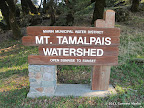
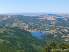
Hikes: Mount Tamalpais is a large park adjacent to Muir Woods National Monument and Marin Municipal Water District. You may form long interesting loops by combining trails from all these parks. Several routes are listed here: Bootjack loop hikesPantoll loop hikesRock Spring loop hikesEast Peak loop hikes.

List of Hikes
9.5 miles
2400 ft
Ben Johnson - Hillside - Ocean View - Redwood - Sun - Dipsea
A great hike through varied terrain including redwoods forests and green rolling hills.

8.4 miles
1500 ft
Dipsea - Coast View - Redwood Creek
A pleasant hike in the southern section of Mt Tamalpais State Park. Great views of the Pacific on a clear day. About half the trail is shaded.

7.0 miles
1800 ft
East Peak from Fern Canyon Road - Route II
A vigorous climb to East Peak for magnificent 360-degree views. Return trip via Middle Peak which also offers great views

7.9 miles
1800 ft
Hillslide - Ben Johnson - TCC - Alpine - Dipsea
Beautiful, mostly shaded route from Muir Woods to Pantoll Ranger Station and back. Tall redwoods, creek crossings.

10.3 miles
1800 ft
Redwood Creek - Dipsea - Homestead Valley - Dias Ridge
An interesting loop combining trails from Mt Tamalpais and Marin Headlands. Two trails have steep sections: Dipsea Trail and Dias Ridge Trail.

31.4 miles
4000 ft
Ridge to Bridge - 2011
Great long hike along Bay Area Ridge Trail from Sir Francis Drake Blvd in the north to Golden Gate Bridge in the south.

2.8 miles
400 ft
Steep Ravine Campground Loop from Highway 1
Nice walk along the Pacific coastline, through rocky and sandy beaches.

5.8 miles
1400 ft
Cataract Falls - Route II
Beautiful shaded hike to a small waterfall, all along a creek that flows with water after seasonal rains.

5.0 miles
1600 ft
East Peak from Fern Canyon Road - Route I
A vigorous climb to East Peak for magnificent 360-degree views.

10.1 miles
2000 ft
East Peak from Pantoll Ranger Station - Route I
Mostly shaded hike with panoramic valley views from East Peak.

8.5 miles
2100 ft
Matt Davis - Coastal - Willow Camp - Steep Ravine
A gorgeous hike along trails meandering along creeks and through redwoods, forests and open spaces. Awesome ocean views as well.

10.8 miles
1700 ft
Redwood_Creek - Miwok - Coastal
Gorgeous hike through varied terrain like hills with valley views, coastal trail with great views of the Pacific, scramble down to a cove.

7.3 miles
1600 ft
Shaded Loop in Mt Tamalpais
A beautiful route through Mt Tamalpais and Muir Woods that is shaded throughout. Many sections are adjacent to creeks, which are full of water after winter rains.

6.5 miles
1500 ft
Steep Ravine - Matt Davis
One of the finest bay area hikes that climbs up an evergreen forest next to a creek.

© Copyright 2008—2023, Gurmeet Manku.