
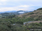
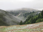
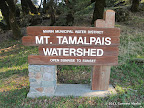
Mt Tamalpais Watershed is a large conservation area in Marin County with 130+ miles of hiking trails.
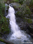
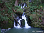
Best Months to Visit: Winter and spring. Cataract Falls is best visited soon after rains.
Parking: Vehicle entrance fees was $8 in Feb 2011 for certain trail heads. Many trailheads are free.
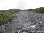
List of Hikes
|
0.7 miles
100 ft |
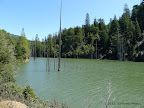
Alpine Lake |

|
9.1 miles
1700 ft |
Carson Falls - Kent Lake - Pine Mountain - Route I |
|
8.4 miles
2100 ft |
Carson Falls - Kent Lake - Pine Mountain - Route II |
|
6.7 miles
1500 ft |
Carson Falls - Kent Lake - Route I |
|
5.5 miles
1500 ft |
Carson Falls - Kent Lake - Route II |

|
6.2 miles
1500 ft |
Carson Falls - Pine Mountain - Route I |

|
5.6 miles
1400 ft |
Carson Falls - Pine Mountain - Route II |
|
3.6 miles
900 ft |
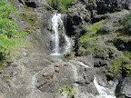
Carson Falls - Route I |
|
2.3 miles
900 ft |
Carson Falls - Route II |
|
8.0 miles
1600 ft |
Carson Falls - Route III |
|
8.0 miles
1800 ft |
Cascade Falls - Pine Mountain |
|
3.1 miles
1000 ft |
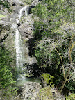
Cataract Falls - Route I |
|
5.8 miles
1400 ft |
Cataract Falls - Route II |
|
10.1 miles
2000 ft |
East Peak from Pantoll Ranger Station - Route I |

© Copyright 2008—2023, Gurmeet Manku.