Bay Area Hikes along Beaches
1 Jan 2012
Hikes listed below entail several miles of walking along single beaches. For routes going through multiple beaches or routes along the coastline that never go through any beaches, see Coastal Hikes. For hikes that do not go along the coastline but offer awesome views of the ocean, see Ocean View Hikes. For hikes that offer awesome views of various bays, check out Bay View Hikes. For hikes through beaches that are possible only in low tide conditions, see Low Tide Hikes. Hikes below are listed geographically, from north to south.
Point Reyes

Point Reyes has several beaches, each with its own character.

3.0 miles
300 ft
Drakes Beach
A beautiful walk through sandy and rocky beaches next to relatively calm Drakes Bay. Drakes Beach provides a sense of isolation. Very few go for a long beach walk beyond Horseshoe Pond in the south. There is a restaurant and swim area at Drakes Beach.

2.0 miles
300 ft
McClures Beach
Peaceful hike to a long sandy beach with some rock outcrops to the south which can be climbed for great views. These rocks are fairly high. Climbing them makes the hike pretty interesting. Views of McClures Beach change dramatically with elevation gain.

Marin Headlands

Marin Headlands has four beaches. From north to south, these are Muir Beach, Rodeo Beach, Black Sands Beach and Kirby Cove. Of these, Black Sands Beachand Kirby Cove are rarely visited. The other two are popular.

2.0 miles
250 ft
Rodeo Beach
Instead of parking the car next to Rodeo Beach, start at Marin Headlands Visitor Center. A trail meanders next to Rodeo Lagoon, slowly descending down to the beach and providing excellent views of the lagoon and the beach. Rodeo Beach is geographically interesting: it is a thin strip of land that separates Rodeo Lagoon from the Pacific Ocean. One may continue beyond the beach to Tennessee Point for a longer hike.

1.6 miles
300 ft
Black Sands Beach
A fantastic short hike that descends 300 ft in 0.3 miles, offering great views of San Francisco, Point Bonita Lighthouse and the Pacific Ocean. Fairly secluded with few visitors. The sand is black, which is why the beach is named Black Sands Beach. The beach is about half a mile long. In the west end of the beach, there is a rocky structure which may be climbed carefully to access another beach.

3.8 miles
900 ft
Kirby Cove
An easy walk down to a quiet beach that offers great views of Golden Gate Bridge. Several campsites and picnic spots near the beach.

San Francisco
9.0 miles
400 ft
Coastal Hike from Mussel Rock to Cliff House
Nice walk along a nine-mile sandy beach extending from Mussel Rock in the south to Cliff House in the north. Right in the middle of the long beach lies Fort Funston area which has hiking trails in cliffs. So the monotony of a nine-mile beach walk may be broken by climbing up the trails in Fort Funston from one side, then descending from the other side. Fort Funston is a paragliding site. So one may see gliders hovering in the sky.

4.0 miles
200 ft
Coastal Hike from Mussel Rock to Fort Funston
A sub-section of the hike above, from Mussel Rock from the south to Fort Funston in the north.

5.3 miles
200 ft
Coastal Hike from Fort Funston to Cliff House
A sub-section of the hike above, from Fort Funston in the south to Cliff House in the north.

Half Moon Bay
13.6 miles
300 ft
Coastal Hike in Half Moon Bay
Half Moon Bay is a six-mile long crescent shaped beach. One may walk the entire length of the beach on sand. Alternately, there are hiking trails parallel to the beach at many locations. Some of these trails are paved bike trails. Some of these trails are atop cliffs, parallel to the coastline, from where gorgeous views of the Pacific and the beaches below are available.

At the north end of Half Moon Bay lies Pillar Point Harbor which has food shops and restrooms. The southernmost access point is Redondo Beach. Starting at Redondo Beach, the hike is about 6.5 miles one-way. One may take a break at Pillar Point Harbor, then return. Alternately, the hike may be started at any point between Redondo Beach and Pillar Point Harbor, making the hike shorter. There are many parking lots all along Half Moon Bay.

Cowell Ranch Beach

Cowell Ranch Beach is a quiet and infrequently visited

2.4 miles
150 ft
Cowell Ranch Beach Walk
The walk from the parking lot to the beach is 0.5 miles long. A flight of steps descends down to the beach. The walk along the beach is about 0.8 miles round trip. There is a bluff trail in the cliffs adjacent to the beach that offers awesome views. For a longer hike, one may walk 3 miles one-way along the Cowell Purisima Trail for great ocean views. The Cowell Purisima Trail is closed during certain months.

Greyhound Rock

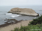
Greyhound Rock has a bunch of rocks near the coastline. Some of these may be climbed, making the hike pretty interesting.

2.8 miles
200 ft
Coastal Walk to Waddell Creek
A pleasant walk next to the Pacific coastline. For a longer hike, one may cross Waddell Creek and continue all the way to Waddell Beach.

Tunitas Creek Beach

Tunitas Creek Beach is unique in that it is accessible only by scrambling down a few hundred feet using a rope which has been set up to assist visitors.

2.3 miles
300 ft
Tunitas Creek Beach Walk
Beach is accessible by a short steep trail. The final descent requires scrambling with the help of ropes. The beach itself is almost one mile long with majestic cliffs separating it from Highway 1 and providing a sense of seclusion.

Crown Memorial Beach

Crown Memorial Beach is a long sandy beach in Alameda, adjacent to San Francisco Bay. One may also walk all along a sidewalk next to a road that parallels the beach.

5.0 miles
0 ft
Crown Memorial Beach Walk
A pleasant beach walk so close to the city.

© Copyright 2008—2023, Gurmeet Manku.