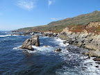
Coastal trails are described in great detail in the book Hiking the California Coastal Trail, Volume 1: Oregon to Monterey (2nd Edition, 320 pages, 2002) by Bob Lorentzen and Richard Nichols. For a multi-day backpacking trip along the coastline, you may have to walk along Highway 1 because the coastal trail is not contiguous. No hike listed below goes through paved roads.
|
7.0 miles
800 ft |
Coastal Trail in Salt Point State Park |

An adventurous hike in Fort Ross Historic Park in Sonoma County. The route alternates between long rocky beaches and sandy beaches. The hike is feasible only in low tide conditions. Few people go along this route, so great solitude is available.
|
7.1 miles
1000 ft |
Sonoma Lost Coast |
|
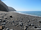
4.5 miles
100 ft |
Unknown Coast in Point Reyes |
|
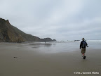
9.5 miles
1000 ft |
Alamere Falls from Palomarin Trailhead |

Close to the junction of Alamere Falls Trail and Coastal Trail, there is an unmarked junction with a trail that goes to Stormy Stack. This side trip is about one mile round trip. The views from Stormy Stack are pretty awesome. This trail is not shown on the official Point Reyes map. It is shown on trail maps sold by Tom Harrison.
|
16.8 miles
2300 ft |
Coastal Trail in Point Reyes |

|
10.0 miles
1200 ft |
Tomales Point |

|
2.1 miles
400 ft |
Chimney Rock |

Mt Tamalpais State Park is a huge park, about 30 minutes north of San Francisco. A part of the park adjoins the Pacific coastline.
|
2.8 miles
400 ft |
Steep Ravine Campground Loop from Highway 1 |

From Official website: Founded in 1970, Slide Ranch is a non-profit teaching farm located at a historic coastal dairy perched above the ocean in the Marin Headlands within the Golden Gate National Recreation Area (GGNRA). Slide Ranch staff operate the farm using a turn of the century farmhouse, old creamery and several outbuildings situated along a scenic coastal bluff. Organic gardens, goats, sheep, chickens and ducks, along with numerous coastal trails, tide-pools and pocket beaches, provide an ideal outdoor venue for teaching about healthy foods, healthy living and environmental awareness.
|
3.8 miles
600 ft |
Muir Beach Overlook to Slide Ranch |

|
11.5 miles
2600 ft |
Coastal Trail in Marin Headlands |

|
8.0 miles
1200 ft |
Coastal Hike from Sutro Heights Park to Crissy Field |

|
4.8 miles
900 ft |
Gray Whale Cove Trail |

|
8.2 miles
900 ft |
Sharp Park Beach to Pacifica State Beach |

|
6.1 miles
700 ft |
Sharp Park Beach to Rockaway State Beach |
|
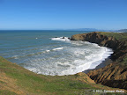
6.4 miles
200 ft |
Cowell Purisima Trail |

|
5.0 miles
250 ft |
Low Tide Hike in Fitzgerald Marine Reserve |
|
2.7 miles
100 ft |
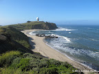
Pillar Point Walk |

|
9.0 miles
100 ft |
Gazos Creek Beach to Table Rock |

|
6.2 miles
100 ft |
Atkinson Bluff Trail |
|
4.0 miles
200 ft |
Elephant Seals Hike |

|
6.2 miles
200 ft |
Ohlone Bluff Trail |

|
8.0 miles
350 ft |
Twin Lakes to Natural Bridges |

|
6.1 miles
200 ft |
Shoreline Walk along West Cliff Drive |

Point Lobos is a small park with a jagged coastline. A trail meanders along the periphery of the park, providing access to beaches, coves and vista points. The views from these locations are superb.
|
2.8 miles
100 ft |
Whalers Cove - Granite Point |

|
3.5 miles
500 ft |
Whalers Cove - Cannery Point - Whalers Knoll |
|
2.6 miles
500 ft |
Soberanes Point - Whale Peak |
